Tell your hiking boots not to take it personally.
On these drives, they may spend most of the day in the trunk.
California has state parks where the windshield gets the best seat in the house. Roads curl through forests, climb into mountain country, and suddenly hand you a Pacific view when you were busy looking somewhere else.
Honestly, keep snacks within reach.
These are the kinds of drives where pulling over is optional, but pointing dramatically out the window is practically guaranteed.
You can stop when curiosity wins. Or stay put and let the scenery keep changing around you.
Just check road conditions before heading out, especially when weather or seasonal closures are in play.
Then hand the passenger the camera.
You have many good excuses to keep driving.
1. Humboldt Redwoods State Park
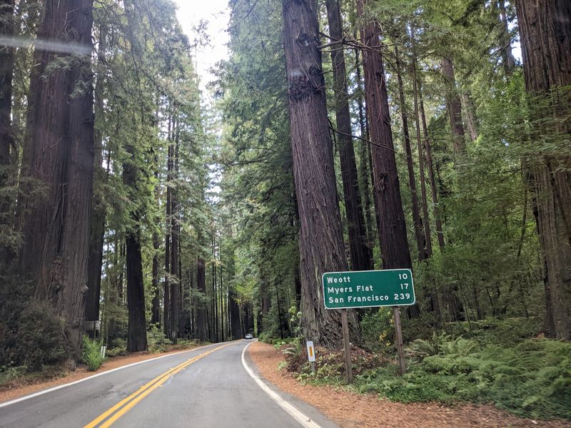
Thirty-two miles beneath redwoods is enough to make Highway 101 feel temporarily irrelevant. The Avenue of the Giants follows State Route 254 through Humboldt Redwoods State Park, running roughly parallel to the freeway between Phillipsville and Pepperwood.
California State Parks points to this drive as one of the best ways to experience the park’s old-growth forest.
More than 17,000 acres of old growth sit within the larger park, including the Rockefeller Forest, recognized as the largest remaining contiguous old-growth coast redwood forest.
The drive itself is the attraction. Trees rise close to the pavement, the road bends through deep green forest, and small communities such as Myers Flat and Weott break up the route. You can pull over for groves and short walks, but the windshield view already delivers plenty.
Give yourself more time than the mileage suggests. The avenue is narrow and winding in places, and racing through defeats the point. Pullouts also make it easy to let faster traffic move ahead while you keep the drive leisurely.
The park is open year-round, and the visitor center sits directly along the Avenue of the Giants. Morning fog is common during summer, while most rain arrives between fall and spring.
Address: 17119 Avenue of the Giants, Weott, CA 95571.
2. Prairie Creek Redwoods State Park
Highway 101 gets you there, but the better drive leaves it behind for ten miles. Newton B. Drury Scenic Parkway runs straight through the heart of Prairie Creek Redwoods State Park, giving drivers a paved route beneath old-growth coast redwoods.
The parkway parallels Highway 101 between signed exits near Orick and Klamath, so there is no complicated detour or need to retrace your route. Without stops, the drive can take only about 20 to 30 minutes, although taking it slowly feels more appropriate.
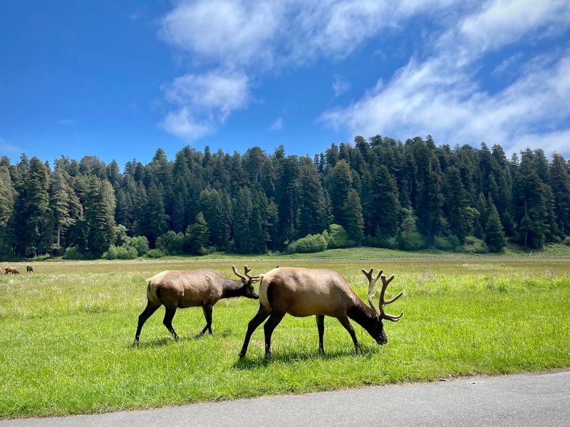
Redwoods crowd the road in long stretches, while Elk Prairie opens the landscape near the southern end. Roosevelt elk use the park’s meadows, so keep plenty of room if animals are visible from the roadway.
Prairie Creek Visitor Center sits near the southern section of the parkway, and Big Tree Wayside is another marked stop nearby. Neither is necessary for the drive to work. The forest remains the main event even with everyone buckled in.
There is one scheduling detail to remember. From fall into spring, designated hike-and-bike days periodically close the parkway to motor vehicles, and winter weather can also cause temporary closures. Check the current road status before building the day’s route around it.
Address: 127011 Newton B. Drury Parkway, Orick, CA 95555.
3. Del Norte Coast Redwoods State Park
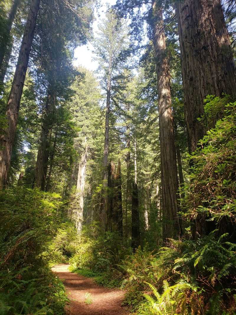
This stretch of U.S. 101 gives you two landscapes at once. Dense redwood forest rises inland while glimpses of the Pacific appear along the steep coastal terrain of Del Norte Coast Redwoods State Park.
The park covers roughly 33,000 acres and forms part of the larger Redwood National and State Parks system. Unlike Newton B. Drury Parkway farther south, this is not a separate scenic loop.
Highway 101 itself is the drive.
That makes it particularly easy to work into a North Coast trip. The road climbs and curves south of Crescent City through forested slopes, with coastal views appearing where the terrain opens.
Fog can narrow those views in the morning, then produce a completely different scene when it hangs between the trees.
Keep the pace comfortable through the curves. This is a road where the passenger may get more sightseeing done than the driver, and that is perfectly fine.
Some park access points are affected by construction in 2026, including the Damnation Creek trailhead and parking area. Those projects can change where you are able to pull off, so current alerts are useful if you are counting on a particular stop.
For the drive itself, though, the combination of coast and redwoods gives Highway 101 plenty to work with.
Address: 1111 2nd St, Crescent City, CA 95531.
4. Mount Diablo State Park
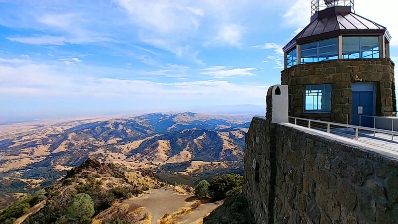
Elevation does most of the storytelling on this drive. Start low among dry hills and oak country, then watch the horizon spread wider with nearly every switchback.
North Gate Road and South Gate Road both provide vehicle access into Mount Diablo State Park and eventually connect with Summit Road. The climb from either entrance to the summit area takes roughly 45 minutes when traffic and conditions cooperate.
The roads are steep, narrow, and winding, so this is better treated as a scenic climb than a quick way to cover miles. Cyclists also use the route heavily, giving drivers another reason to keep the pace measured.
As you gain elevation, views open across Contra Costa County and farther portions of the Bay Area. The summit sits at 3,849 feet, and the upper parking area lets you reach the highest section of the road without needing a hike.
A ten dollars vehicle day-use fee currently applies at the North and South Gate entrances. Gates open at 8 a.m. and close at sunset, and visitors need to be heading toward an exit by the end of the day.
Use one of the actual summit-access entrances rather than Mitchell Canyon, which does not provide vehicle access to the top.
Address: 2675 Mt. Diablo Scenic Blvd, Blackhawk, CA 94506.
5. Anza-Borrego Desert State Park
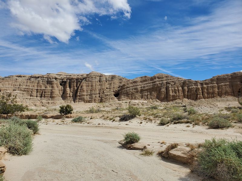
Few drives change character as dramatically as the roads into California’s largest state park. Anza-Borrego covers more than 600,000 acres, with mountain approaches giving way to broad desert basins, badlands, washes, and long horizons.
S22, S2, and Highway 78 all provide scenic approaches into the park. Coming from higher terrain, the roads descend toward the Colorado Desert, and that elevation change gives you some of the biggest windshield views on the list.
S22 is especially memorable on the approach toward Borrego Springs. Montezuma Valley Road twists down toward the valley, with broad desert country spreading below as the road loses elevation.
Once you reach the basin, the scale changes again. Mountains sit farther away, the sky seems to take up more room, and the roads run through a much more open landscape than the mountain approach suggests.
You can spend days exploring Anza-Borrego’s back roads, but plenty of the experience works on paved routes. Stay with the main highways if the goal is simply a scenic drive without adding rough-road questions.
Desert temperatures can remain high well beyond summer, so water and a full fuel tank are useful even when nobody intends to leave the vehicle for long.
Address: 200 Palm Canyon Dr, Borrego Springs, CA 92004.
6. Cuyamaca Rancho State Park
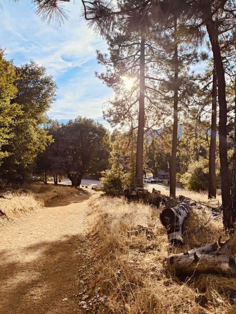
Highway 79 gives drivers a mountain transition before the desert begins. About 50 miles east of San Diego, the road runs generally through Cuyamaca Rancho State Park, passing oak woodland, pine country, broad meadows, and higher elevations.
This landscape is a sharp contrast with Anza-Borrego just to the east. That difference is part of the fun if you drive the two areas on the same day. Cuyamaca feels cooler and more enclosed, then the terrain changes quickly as routes descend toward the desert.
Cuyamaca Peak rises to 6,512 feet within the park, while Highway 79 stays much lower and handles the sightseeing without asking the car to climb to the summit. Lake Cuyamaca sits north of the main park area and adds another change of scenery along the corridor.
The park also preserves reminders of its mining past. Stonewall Mine lies near the highway, although visiting the mine itself requires getting out of the car.
For a windshield-only afternoon, simply stay on Highway 79 and let the changes in elevation, forest, and meadow carry the drive. The road continues toward Julian to the north, making it easy to extend the outing without doubling back.
Address: 13652 Highway 79, Julian, CA 92036.
7. Red Rock Canyon State Park
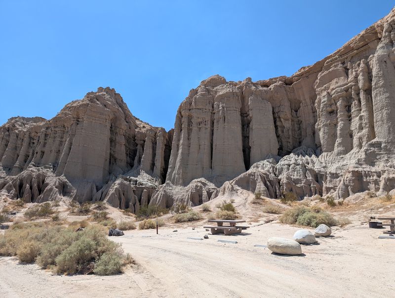
The color shows up before you need a trail map. Red, white, pink, and brown layers rise beside Highway 14 in the western Mojave, turning the approach to Red Rock Canyon State Park into its own roadside exhibit.
The park sits about 25 miles northeast of Mojave near Cantil. Highway 14 runs directly alongside its dramatic cliffs and buttes, so even drivers who never turn onto a dirt route still get a strong look at the geology.
For a closer view, Abbott Drive leads about a quarter mile from the highway toward the developed park area. Licensed vehicles can also use designated primitive roads inside the park, though surface conditions vary and some routes may be temporarily closed.
That gives you two versions of the drive. Stay on pavement and let Highway 14 handle the scenery, or use marked park roads if your vehicle and current conditions make that comfortable.
The cliffs change noticeably with the light. Late afternoon tends to deepen the reds and shadows, while brighter midday conditions make the stripes and pale layers easier to pick out.
Keep to designated roads if you venture beyond pavement. Desert soils are easily disturbed, and current park maps identify which vehicle routes are open.
Address: 37749 Abbott Dr, Cantil, CA 93519.
8. Calaveras Big Trees State Park
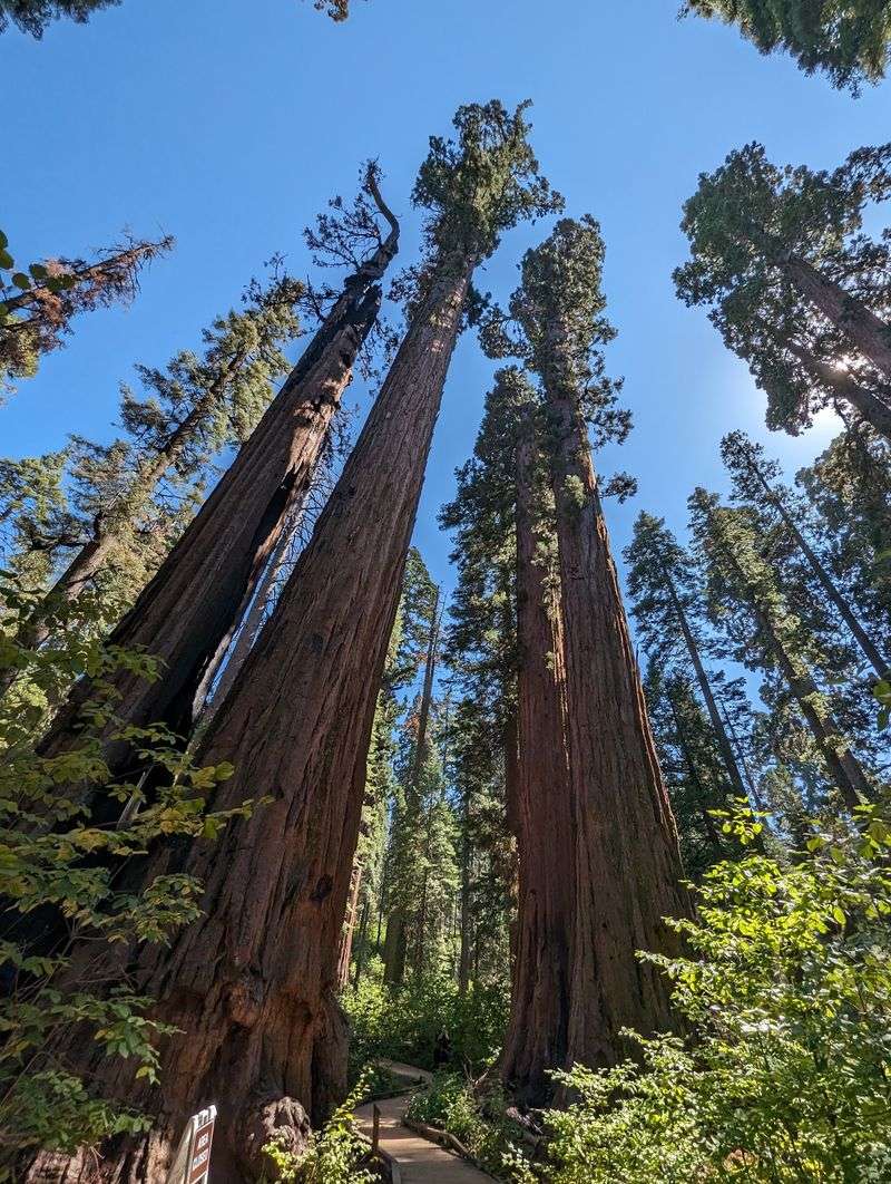
The famous giant sequoias may encourage you to get out and walk, but the road through the park still earns its place on this list. Walter W. Smith Memorial Parkway carries vehicles deeper into a Sierra forest of firs, pines, meadows, and river country.
Calaveras Big Trees State Park protects both the North and South groves of giant sequoias. The parkway extends beyond the visitor center toward the Stanislaus River and South Grove area, turning the drive into more than a quick entrance-road loop.
Do not expect every famous sequoia to stand beside the pavement. The biggest tree experiences require walking. From the car, the payoff is the larger forest setting, changing elevation, and access to the river corridor.
This road is also distinctly seasonal. California State Parks closes the parkway after the first significant snowfall or December 1, whichever comes first. Reopening normally happens May 1 or later depending on snow.
Temporary management work can affect access too. Prescribed fire projects scheduled around late September 2026 may bring partial closures in portions of the South Grove and parkway area.
If the road is open, take it slowly and let the Sierra forest be the reason for the drive rather than treating the sequoias as the only attraction.
Address: 1170 E Highway 4, Arnold, CA 95223.
9. Sonoma Coast State Park
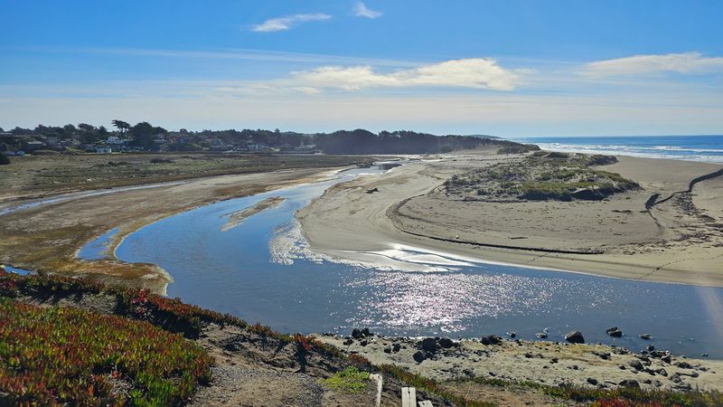
Highway 1 does nearly all the work here. Sonoma Coast State Park stretches for about 17 miles between Bodega Head and a point north of Jenner, with beaches, bluffs, coves, and headlands appearing one after another along the route.
The road stays close enough to the coast that you can build an entire afternoon around short scenic segments without needing a hiking plan.
More than a dozen beach access points sit along this stretch, but pulling over is optional when the goal is simply watching the shoreline unfold.
Bodega Bay gives way to open headlands, rocky coves, and long ocean views. Near Jenner, the Russian River reaches the Pacific, adding a broad estuary scene to the drive.
North Coast weather keeps the route unpredictable in a good way. Summer fog is common and may soften the horizon, while clearer stretches suddenly open long views down the shoreline.
Highway 1 becomes more winding as you continue north, so keep the pace easy and use established turnouts when you want to pause. This is a route where adding ten minutes rarely feels like a problem.
The park remains open for day use, with beaches and viewpoints spread across multiple access areas rather than one central entrance.
Address: 3095 N Highway 1, Bodega Bay, CA 94923.
10. Salt Point State Park
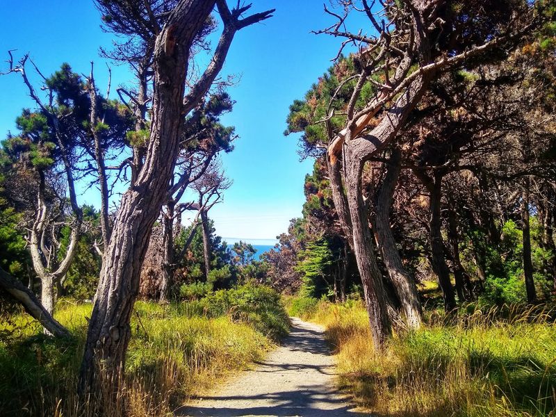
Continue north on Highway 1 and the coast becomes rougher, quieter, and more forested. Salt Point State Park protects more than six miles of shoreline along with grasslands, forested hills, and coves scattered beneath the road.
The highway runs directly through the larger park area, making this an easy continuation of a Sonoma Coast drive. One bend may give you open Pacific views while the next moves back among trees and coastal slopes.
Salt Point is especially known for sandstone formations carved into honeycomb-like tafoni patterns, although those details are better appreciated after stepping out near places such as Gerstle Cove or Fisk Mill. You do not need them for the drive itself to work.
The contrast between coast and forest does most of the heavy lifting from the car. Inland portions include pines, firs, redwoods, grasslands, and smaller forest types, while the west side repeatedly returns your attention to the ocean.
Services are limited along this stretch. The park notes that the nearest fuel stations are roughly 18 miles away in either direction, so this is a better place to arrive prepared than to start watching the gauge halfway through.
Cell service may also fade. That only makes the old-fashioned approach more useful: know the route, fill the tank, and let Highway 1 handle the afternoon.
Address: 25050 Highway 1, Jenner, CA 95450.
11. Emerald Bay State Park
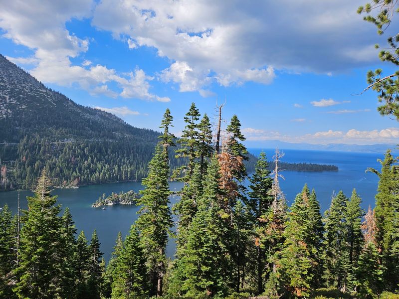
Highway 89 delivers the view before you ever reach lake level. The road traces the southwest side of Lake Tahoe and climbs above Emerald Bay, giving drivers elevated looks across blue-green water, Fannette Island, and the surrounding Sierra slopes.
Vehicles do not drive down to the shore itself, which actually strengthens the case for this list. The classic Emerald Bay perspective comes from Highway 89 and its overlooks rather than from a road beside the water.
Inspiration Point is the best-known stop along the route, but the scenery begins before you pull into a parking area. Curves around the bay repeatedly reveal pieces of Tahoe through the trees, then open into wider views as elevation and road angle change.
Fannette Island sits near the center of the bay and is the only island in Lake Tahoe. A small stone tea house built in the late 1920s still stands on top, although you will need good eyesight to pick out details from the highway.
Season matters here more than on most entries. Highway 89 around Emerald Bay can require chains or four-wheel drive during winter conditions and may close temporarily when snow or road conditions call for it.
When the route is open, it is one of California’s easiest arguments for staying in the car a little longer.
Address: 138 Emerald Bay Rd, South Lake Tahoe, CA 96150.