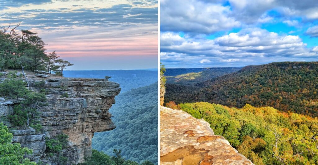
Your calves are going to have questions.
The western edge of Tennessee’s Cumberland Plateau does not waste much time getting serious. Roads give way to trailheads, the ground starts dropping, and suddenly that “easy little hike” deserves a second look.
This place is huge, with nearly 60 miles of trails spread across a landscape that can make one afternoon feel very ambitious.
The funny part is how quickly the map starts lying to your brain. A few miles looks harmless on paper. Add a gorge, a climb back out, and one scenic detour, and those miles suddenly develop personality.
That is why the park feels bigger than the numbers suggest.
Some routes stay manageable. Others quickly remind you that gorges have a sense of humor.
You arrive thinking you are choosing a hike.
A few miles later, the hike has clearly chosen you.
The Gulf Opens Into A Huge Cumberland Plateau Landscape
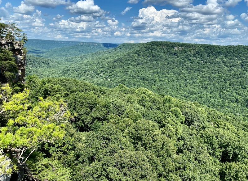
Savage Gulf is shaped by a network of deep gorges rather than one single canyon. Big Creek, Collins River, and Savage Creek run through narrow gulfs cut into the Cumberland Plateau, and each drops more than 800 feet over roughly five miles.
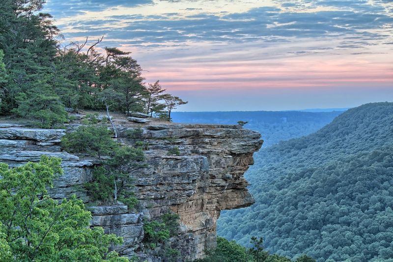
Sheer sandstone cliffs rise above the forest, while streams, sinks, and rocky passages break up the terrain below.
The 15,590-acre natural area sits within the larger state park and has its own long conservation history.
Much of the protected land is in Grundy and Sequatchie counties, where the plateau gives way to steep slopes and gorge floors.
The result is a park where two trails of the same mileage can demand very different amounts of time.
That matters when planning the day. A rim walk may stay relatively level for stretches, while a route into a gulf can trade easy footing for rock, roots, and a climb back out. Pick the scenery first, then check the distance and terrain before committing.
For a lighter visit, an overlook can deliver the scale without turning the afternoon into an endurance test. Longer routes let the gorge do the talking up close, but they deserve enough daylight, water, and energy for the return.
Stone Door Gives The Park Its Most Distinctive Passage
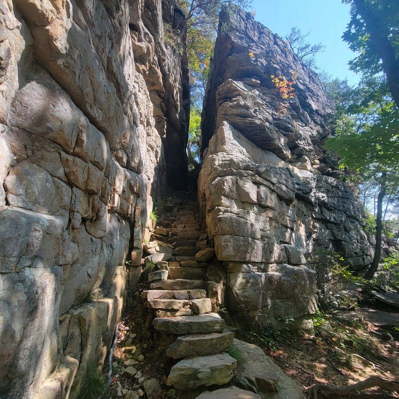
The Great Stone Door is one of the clearest examples of how unusual this landscape can get. A natural crack splits the sandstone escarpment about 10 feet wide and 100 feet deep, creating a passage from the plateau toward the gorge below.
It looks less like a tidy doorway and more like the cliff decided to leave itself slightly open.
The Stone Door Trail is about 0.9 mile one way, making this one of the more manageable outings in a park known for rugged hiking.
A paved route from the north trailhead reaches Laurel Gulf Overlook, giving visitors a way to see the gulf before the trail continues toward rougher ground near the rock formation.
Once the pavement ends, roots, rock, and bluff edges become part of the outing. This is where sturdy footwear stops being a suggestion and starts earning its place in the car.
The north trailhead also makes a practical base for a shorter first visit because restrooms, a ranger station, a picnic area, and a pavilion are concentrated there.
The question is simple: stop after the overlook and Stone Door, or keep going into a longer trail day. Your knees may have opinions.
Trail Mileage Can Be Deceptive Here
Savage Gulf has approximately 60 miles of hiking, and the trail system connects overlooks, waterfalls, gorge routes, historic features, and backcountry camping areas. That gives you plenty of choices, but the number beside a trail name does not tell the whole story.
The Stone Door Trail stays short enough for a focused outing. The Savage Day Loop is about 4.2 miles and reaches the area around Savage Falls. Other routes descend into the gulfs, cross rocky terrain, and demand more climbing on the way back.
Even experienced hikers should look at terrain and elevation instead of choosing by mileage alone.
The simplest approach is to give the day one main target. Stone Door works when the rock formation and overlook are the priority. Savage Falls suits a waterfall-centered loop.
A deeper gulf route makes more sense when you have the time and gear for a longer stretch away from the trailhead.
Carry water, bring a current trail map, and leave enough daylight for the return. Weather matters too. Heavy rain can change stream conditions quickly in the gulfs, and wet stone does not care how confident your hiking shoes made you feel in the parking lot.
Greeter Falls And Savage Falls Offer Two Different Waterfall Days
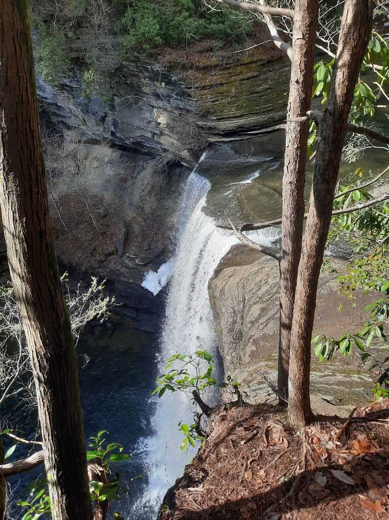
Water plays a major role across Savage Gulf, but the waterfall experience changes depending on which trailhead you choose.
Greeter Falls sits on the western side of the park, where Firescald Creek drops over a 15-foot upper ledge and then falls another 50 feet at Lower Greeter Falls.
The route to the lower falls includes a metal spiral staircase, one of those trail details that makes the walk as memorable as the destination.
Nearby water features give the western side enough variety for visitors who want to make waterfalls the main event rather than a side stop.
Savage Falls offers a different outing on the eastern side. Savage Creek drops about 30 feet there, and the falls can be reached as part of the roughly 4.2-mile Savage Day Loop. That route asks for more walking, but it also turns the waterfall into part of a broader forest hike.
Flow naturally changes with rainfall, so no waterfall should be treated like a machine with an on switch. After wetter periods, the sound can reach you before the view does. During drier weather, the experience may be quieter.
Around any falls, slow down on wet rock and stay with the established trail. Mist and smooth stone can make a very convincing team.
Old-Growth Forest Gives The Park A Quieter Side
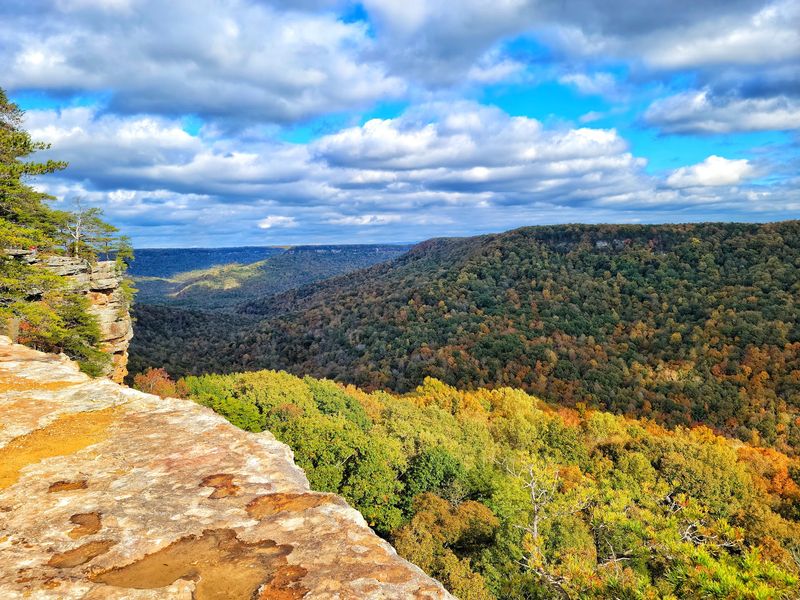
Big cliffs get the dramatic photographs, but Savage Gulf also protects a substantial section of old-growth forest.
Much of the gorge is second-growth woodland, while a large area of old-growth mixed mesophytic forest remains within the natural area.
Old-growth shortleaf pine also survives in the uplands.
Oaks, hickories, maples, yellow poplars, hemlocks, and pines grow across the park, with ferns, mosses, vines, shrubs, and wildflowers filling the lower layers.
Collins Gulf is especially noted for spring wildflowers, adding another reason to look down occasionally instead of spending the whole hike staring toward the cliffs.
Savage Gulf is also included on the Registry of National Natural Landmarks. The designation reflects the significance of the natural area, where geology, forest communities, and gorge systems come together across a large protected landscape.
This part of the park rewards a slower pace. The shift from plateau forest to cooler gorge terrain can be as interesting as any single overlook. In spring, wildflowers take their turn.
In autumn, changing leaves open and close views through the forest. Even on the same trail, the season can rearrange what catches your eye.
Backcountry Camping Opens Up The Longer Routes
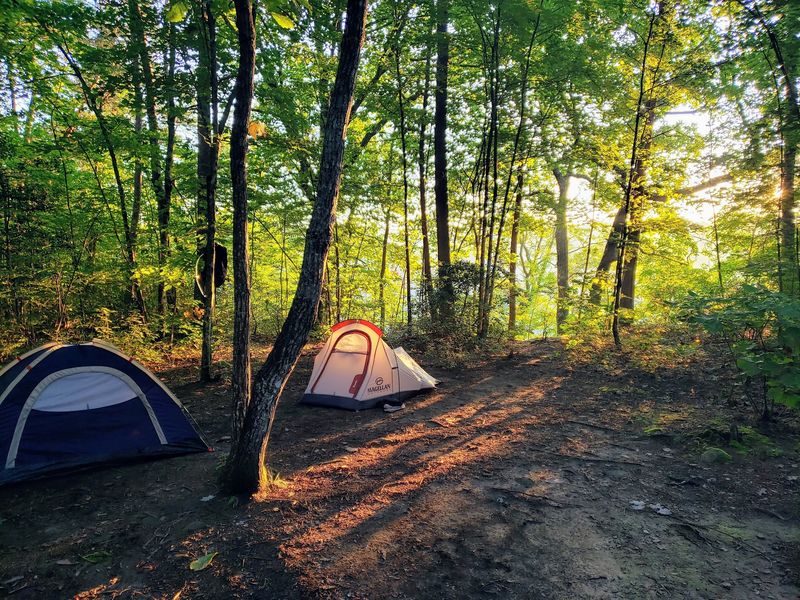
A day hike only shows part of Savage Gulf. The park has nine backcountry campgrounds and more than 70 backcountry campsites, giving hikers a way to build overnight routes through sections that would be difficult to cover comfortably between breakfast and sunset.
Camping requires planning rather than improvisation. Sites are reservable, and backcountry hikers need the appropriate permit.
Once a pack is involved, rocky descents and climbs also take more time, so the mileage between the trailhead, campsite, and next day’s exit deserves a conservative reading.
For visitors staying above the gorge, the north side remains one of the easiest places to organize the day.
The Stone Door area combines trail access with basic facilities, while the other trailheads connect to different parts of the park.
Navigation apps can be unreliable around Savage Gulf, so choosing the correct trailhead before leaving stronger service is a smart move.
The north trailhead and park contact point is at 1183 Stone Door Rd, Beersheba Springs, TN 37305. In fall, the Stone Door gift shop operates from 8 a.m. to 4 p.m. The trails themselves deserve a daylight plan, especially when a route includes steep or rocky ground.
An overnight can stretch the experience, but a shorter trip is perfectly reasonable. Savage Gulf is not handing out prizes for carrying the heaviest backpack.
Savage Gulf Became Its Own State Park In 2022
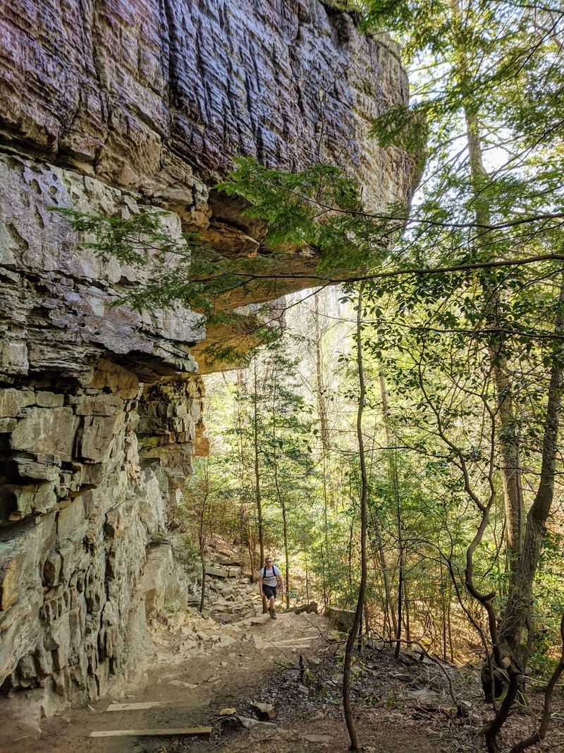
Savage Gulf spent years managed as part of South Cumberland State Park before becoming a separate Tennessee state park on October 1, 2022.
The change created a park centered on the Savage Gulf landscape while the designated state natural area remained protected within it.
The natural area itself predates the state park by decades. Its protected acreage remains part of the newer park, keeping the long-established conservation area at the center of the landscape visitors hike today.
Today, the combination of roughly 60 miles of hiking, four main trailhead parking areas, nine backcountry campgrounds, waterfalls, sandstone cliffs, and the Great Stone Door gives visitors several ways to approach the same landscape.
A casual outing does not need the same plan as a full gulf descent, and that flexibility is useful in a place this large.
Start small if it is your first time. Stone Door and an overlook can fill a morning without requiring a major expedition. A waterfall loop can take the next visit.
Backcountry routes can wait until you know how the terrain behaves under your boots.
Savage Gulf does not need an overloaded itinerary. Give one corner of the park enough time, and the rest becomes a very good reason to come back.