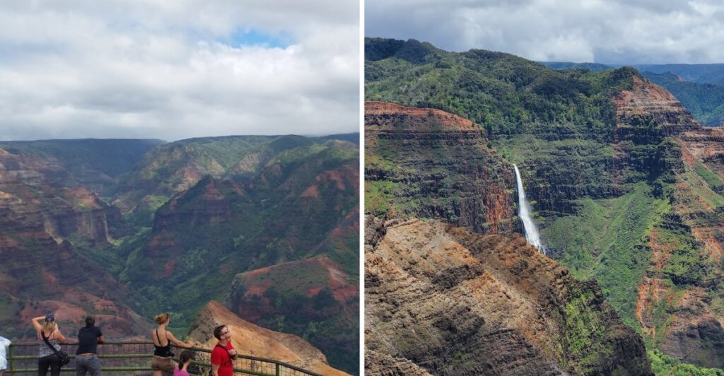
Okay, this is not the Hawaii postcard most people have in mind.
You expect palm trees and ocean.
Then you look down.
A huge canyon opens beneath you, with red walls and green ridges dropping away into the distance. Waterfalls appear here and there, just to make the whole view even harder to process.
That is what makes this part of Hawaii such a curveball.
Normally, the drive brings you to overlooks without asking much from your legs. Trails can take the adventure farther.
Right now, though, the canyon is asking for patience.
As of October 2026, the park and access road remain closed after severe storm damage. Reopening depends on official updates.
When the road finally opens again, I have a feeling plenty of people will be asking the same thing:
How was this hiding on an island?
Why Kauai Earned A Grand Canyon Nickname
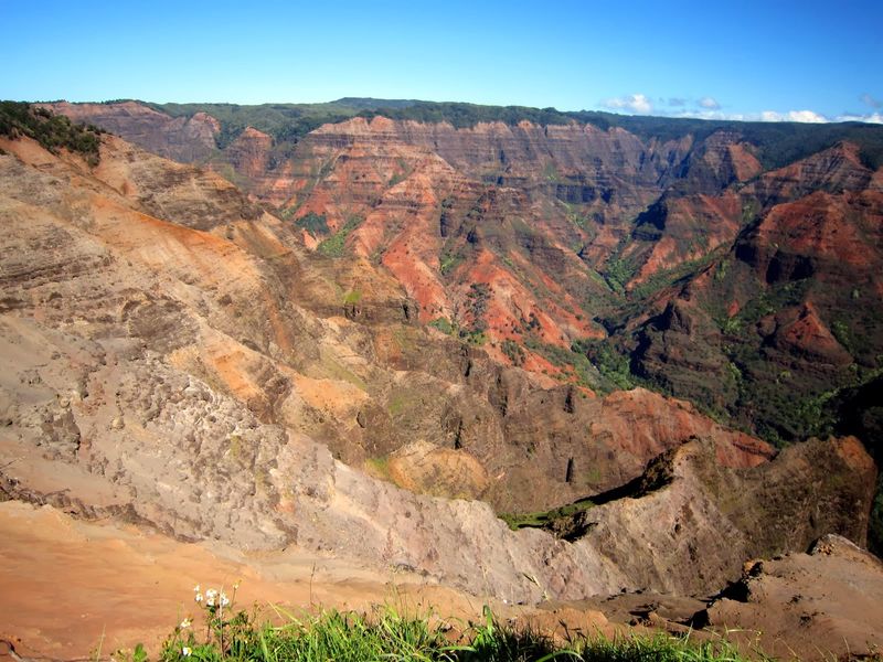
A nickname that brings Arizona to mind makes sense when you see the scale of Waimea Canyon. Deep walls descend from high ridges, and long folds of land stretch into the distance.
Here, though, the rock’s red and orange tones share space with green slopes and vegetation growing wherever moisture and soil allow.
The canyon belongs to a wetter, more tropical island landscape than the deserts surrounding much of Arizona’s Grand Canyon.
Passing clouds can change which cliffs are illuminated and which disappear into shadow. After rain, greenery may stand out sharply against the exposed reddish rock.
When the park reopens, the overlooks will offer a way to appreciate that contrast without descending into the gorge. You can concentrate on the broad canyon at one stop and look for smaller details, such as layered rock or distant streams, at another.
Higher viewpoints can be cool, windy, or misty even when the beaches below are warm. Pack a light jacket and a rain shell, and allow room in your schedule for changing visibility. Stay in designated viewing areas and let the clouds move on their own schedule.
Fourteen Miles Of Twists, Turns, And Big Views
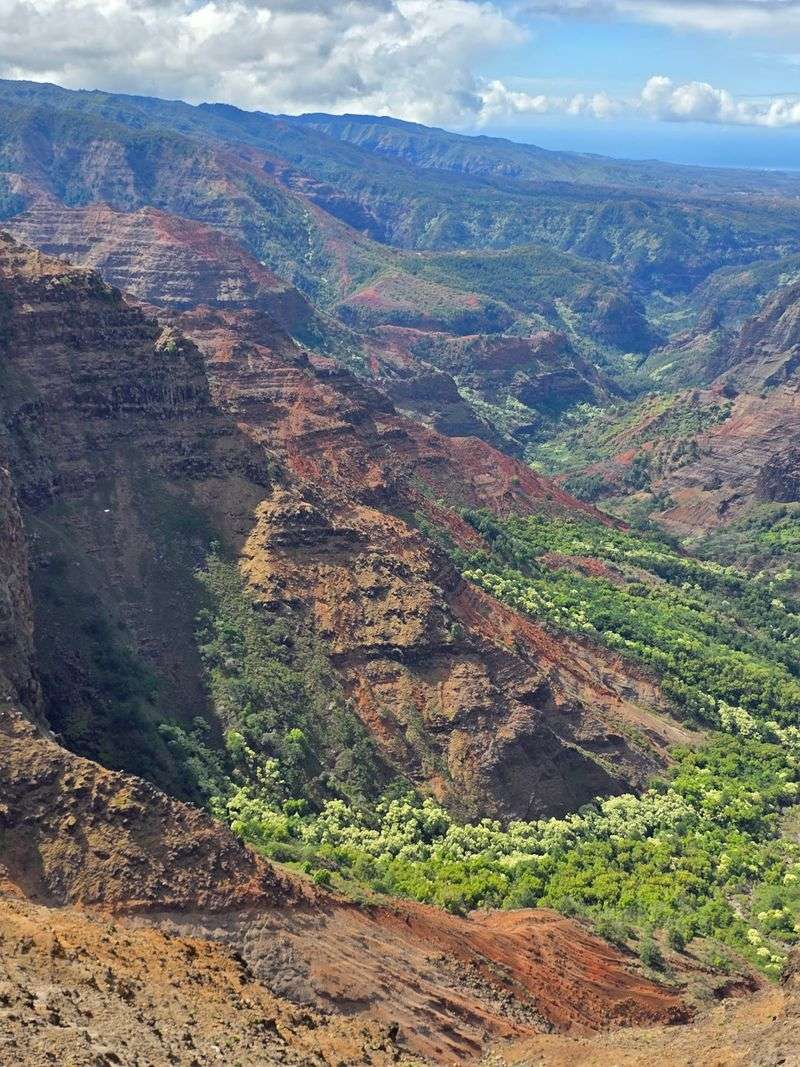
Waimea Canyon stretches about 14 miles through western Kauai. That figure describes the canyon itself, not a promise of a quick 14-mile sightseeing drive.
The mountain roads leading toward its viewpoints wind around ridges, gain elevation, and demand attention from the person driving.
When the road reopens, the drive will wind past wooded hillsides and stretches of open mountain scenery.
If winding roads tend to leave you queasy, plan for the curves before beginning the climb. Sitting where you can look ahead may help, and taking a proper break at a designated stopping area is better than asking the driver to pull over unexpectedly.
The closure matters here as much as it does at the park entrance. Storm damage can affect road surfaces, slopes, and access farther uphill. Do not try to reach the canyon by a side road or continue around barriers.
Wait until state authorities confirm that the route and intended stops have reopened.
Once the drive is permitted again, allow a generous portion of the day rather than trying to squeeze several mountain stops between tightly timed plans.
Cliffs That Plunge Deeper Than You Expect
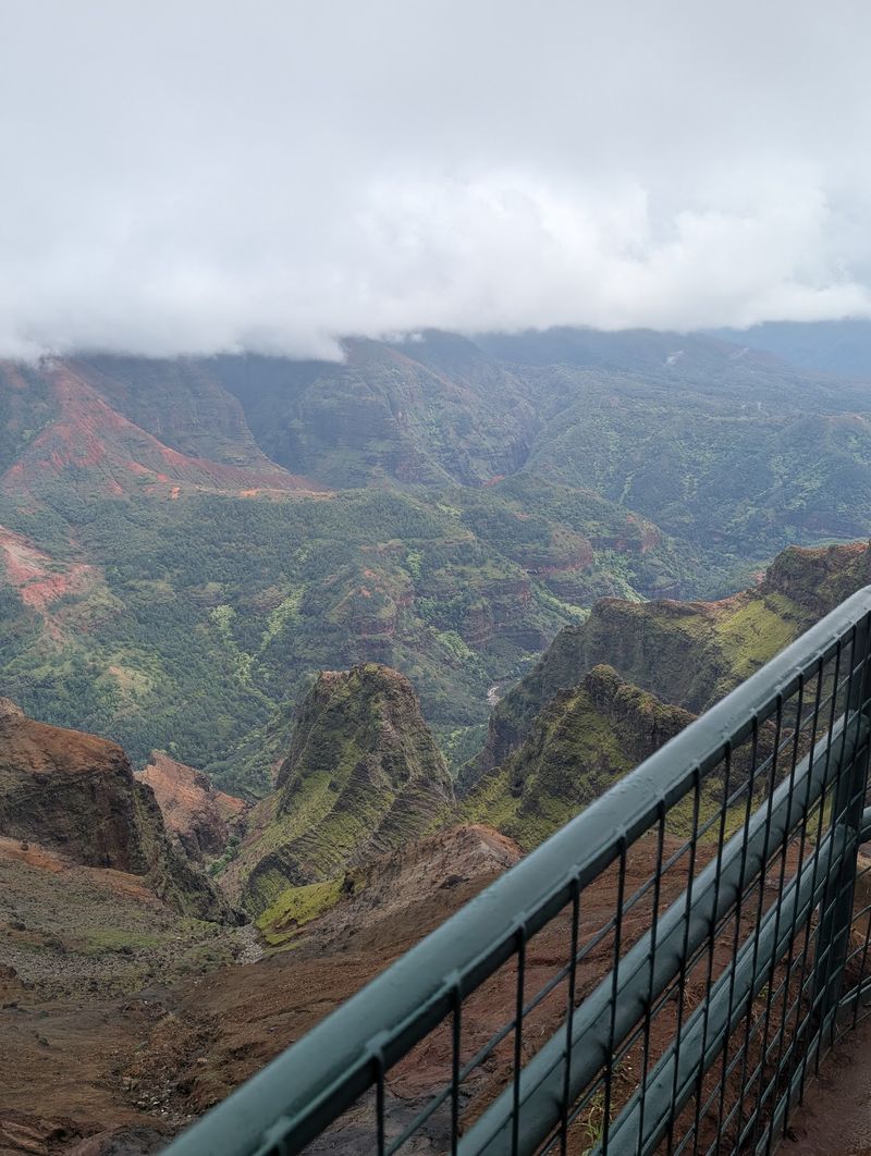
Waimea Canyon reaches depths of approximately 3,600 feet. From high viewpoints, the land drops through a maze of ridges toward the valley floor, where streams and vegetation occupy the lower ground.
Rather than one uniform trench, the canyon contains branching valleys, projecting ridges, and rock faces with different slopes. Some sections expose broad bands of red earth; others support dense pockets of green plants.
Cloud cover can make the depth harder to judge. A distant ridge may be sharp in clear light, then become partly hidden as mist crosses the valley.
When overlooks reopen, keep behind railings and away from unstable cliff edges. Loose ground and steep drop-offs can be dangerous even a few steps beyond a formal viewing area. Hold onto loose hats and secure cameras before stepping out in gusty conditions.
Traveling with children? Agree on the boundaries before approaching the overlook and keep younger visitors close. The height and layered canyon walls are visible from the proper paths, where everyone can take a little time to look around.
Colors That Look Freshly Painted
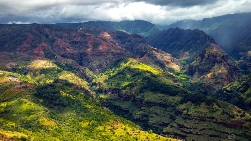
Rust, tangerine, deep brown, and green appear across the canyon walls in broad patches and narrow bands. The warm tones come partly from iron-bearing volcanic material that changed as it weathered, while living plants add vivid greens to ledges and wetter slopes.
The colors also depend on the light. Sunshine can brighten an exposed wall while clouds cast a cooler shadow across its neighbor. The view can change without the rocks themselves changing color.
If you’re hoping to photograph those differences once access is restored, leave time for more than a single picture. A wider frame can show the relationship between ridges, while a closer composition draws attention to the contrast between vegetation and exposed rock.
Conditions may be hazy or bright, so a little patience with the light is more useful than trying to reach an unsafe vantage point.
A rainbow sometimes appears when sunlight and passing showers line up, but it isn’t something to count on. If weather turns rough, seek a safe sheltered place rather than lingering beside an exposed drop.
How Fire And Water Carved A Masterpiece
The story begins with volcanoes. Kauai formed through extensive volcanic activity, which built the island from successive lava flows. Over time, changes in the volcanic structure, including a major collapse, helped shape the terrain that water later cut into more deeply.
Rainfall and flowing streams eroded the rock, widening and deepening the valleys. The Waimea River played an important role in carving the canyon, carrying water and sediment toward the coast.
Its work continued long after the island’s principal volcanic building phase ended.
The visible layers reflect parts of that history. Some bands represent different volcanic deposits, while weathering and erosion exposed surfaces with varying mineral content and texture.
The red and orange hues are particularly noticeable where rock and soil have been altered over time.
Stand at a permitted lookout after the park reopens and follow the ridges with your eyes. Some extend toward the center of the gorge; others are interrupted by smaller drainage channels. Each channel offers a clue to how water moves through the landscape.
You don’t need to leave the marked paths or collect rocks to see the evidence laid out across the canyon walls.
Overlooks Worth Pulling Over For
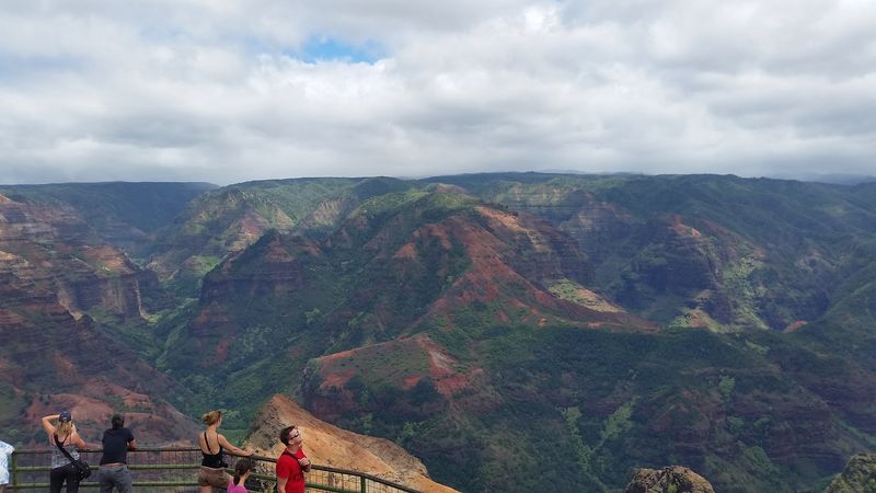
When the park and roads are open, designated overlooks give you different angles on Waimea Canyon without requiring a hike into the gorge.
Waimea Canyon Lookout is the main panorama stop, with a view across ridges and exposed rock walls. Puʻu Hinahina Lookout offers another perspective farther along the mountain route.
These are established stopping areas, not invitations to park on a narrow bend or walk into traffic for a photograph.
Use marked parking spaces and follow signs or barriers governing access. Some viewpoints have stairs or uneven surfaces, so check the approach if anyone in your group needs an easier walk.
For now, the access situation comes first. Waimea Canyon State Park and Kōkeʻe Road remain closed following storm damage in October 2026. The viewpoints should not be treated as available until authorities announce reopening.
Even then, check which individual facilities and roads have returned to service.
Waimea Canyon State Park lies along Waimea Canyon Drive, above Waimea on Kauai’s western side.
Once visits resume, decide whether you’d rather spend extra time at one overlook or make several shorter stops. Leave space for clouds to clear, keep children away from exposed edges, and remember that mountain weather can change between viewpoints.
Trails And Waterfalls For Curious Feet
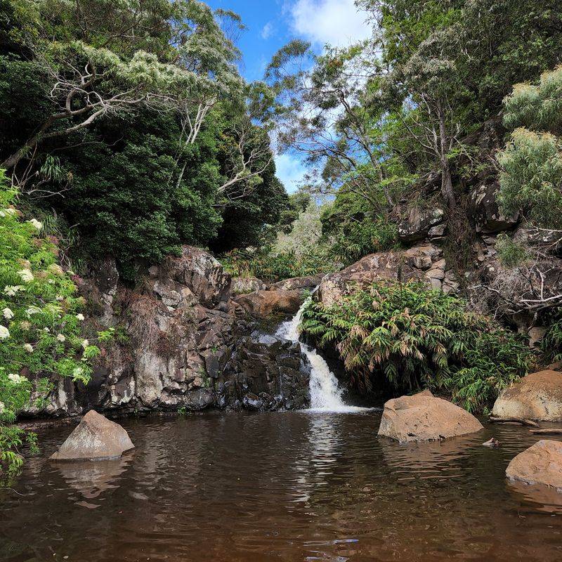
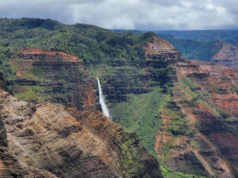
Beyond the roadside panoramas, trails explore sections of the upland forest and canyon rim. Waipoʻo Falls is one of the canyon’s recognizable sights, dropping down a distant rock wall when water is flowing.
From certain viewpoints, the waterfall appears as a pale line against the darker cliff.
The Canyon Trail leads toward the upper area of Waipoʻo Falls, not to the base of its main drop. Depending on the starting point, a hike can involve several miles of walking, uneven ground, steep sections, and slippery red soil.
The short Iliau Nature Loop is a different kind of outing, while the Kukui Trail makes a much more demanding descent toward the canyon floor.
These are options for a future visit, not routes to attempt during the present closures. Storm damage has affected trails and crossings, and entering closed areas can expose hikers to washouts, unstable slopes, and other hazards.
Check current trail notices after the park reopens; a reopened road does not automatically mean every trail is ready.
When hiking is allowed again, choose a route for your group’s experience and the day’s conditions. Wear footwear with reliable grip, carry plenty of water, and allow enough daylight for the return. A rain layer belongs in the pack even if the morning begins clear.
Finally, that famous red dirt can cling stubbornly to shoes and clothing. Choose gear that handles mud, stay on marked trails, and leave the canyon’s rocks, plants, and flowing water undisturbed.
There will be plenty to discover from the established routes when they are safe to explore again.