Some mountain towns make you earn the trailhead with another hour behind the wheel.
This one practically hands you hiking shoes at the curb.
The river squeezes between two mountains here, and trails start close enough to town that the car can finally stop being the main character.
That is where this corner of Virginia gets interesting.
You can head toward waterfalls, climb for wider ridge views, or pick up part of a much longer trail without turning the day into a transportation project.
I would choose one route and let it have the afternoon.
The town is compact, the river stays close, and another trail is always sitting there like a very convincing backup plan.
The real trouble is not finding somewhere to walk.
It is explaining to your legs why you chose the hill.
The New River Gives The Town Its Name
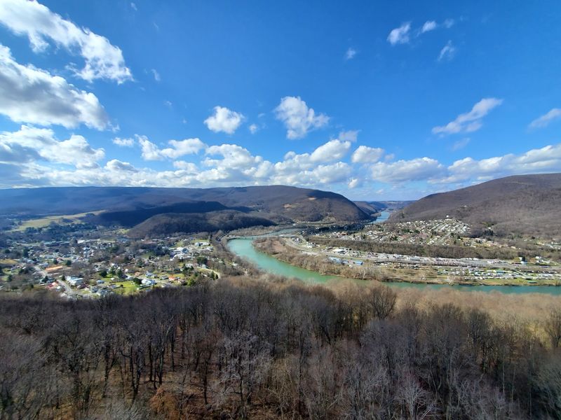
Narrows takes its name from the place where the New River cuts between East River Mountain and Peters Mountain. The waterway narrows as it passes through the ridges, creating the geographic feature that became the town’s identity.
That setting is easy to notice once you arrive. Mountains rise close to the streets, and the river runs directly through the community rather than sitting somewhere beyond the edge of town.
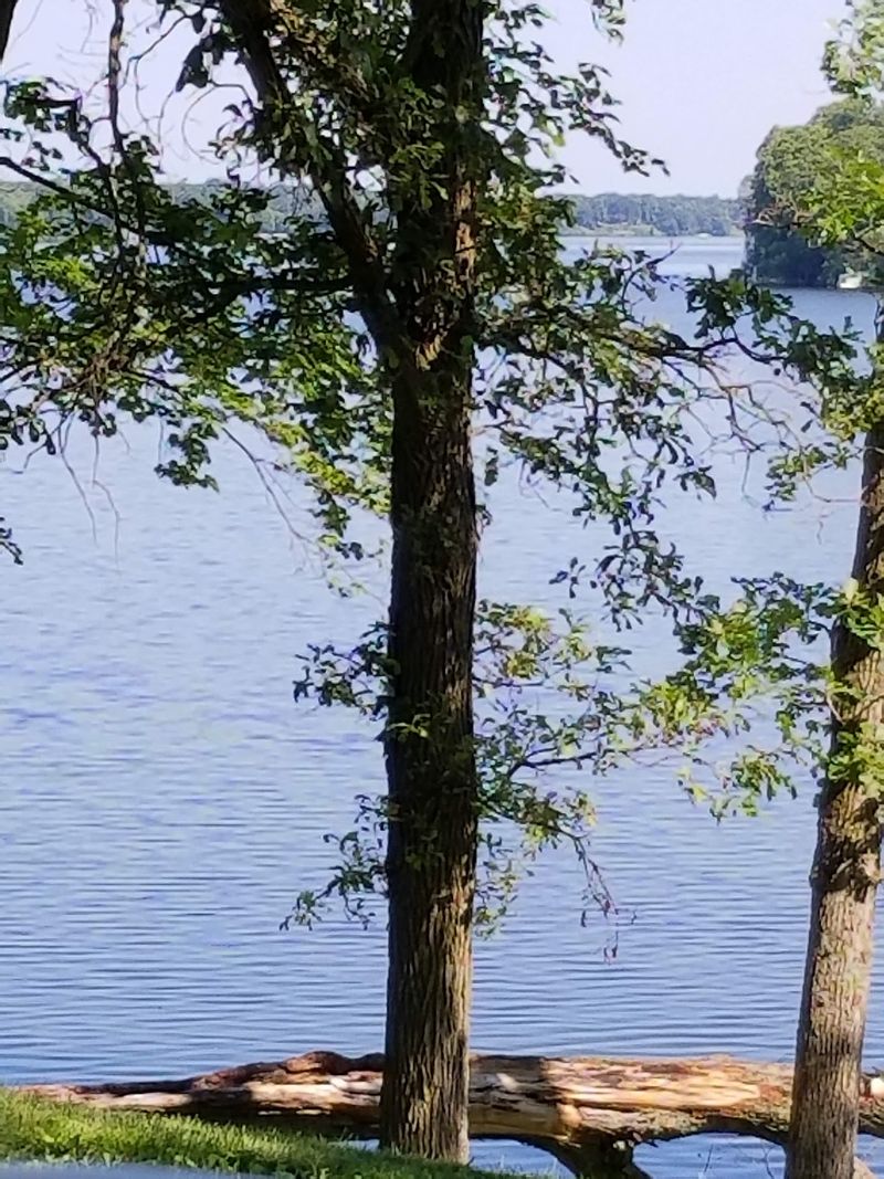
The New River also gives the area another layer of outdoor access beyond hiking. Fishing and paddling are both part of recreation in Giles County, and the river can turn a trail-focused day into something broader if you are staying longer.
Water levels and conditions can change after rain, so anyone launching a boat should check current river information before heading out. If you are only stopping to look, the river still helps explain why the town sits where it does.
The name may sound simple, but the geography is doing most of the work. Stand near the river and look toward the ridges, and the shape of the town starts to make sense.
That is a useful first stop before the hiking boots come out.
Downtown Makes A Practical Starting Point
Narrows is small enough that the town and the surrounding outdoor access feel closely connected.
The Appalachian Trail Conservancy includes the community in its A.T. Community program, and downtown gives you a practical place to get oriented before heading toward nearby trails.
The town center is not the reason to rush through the day. It gives you a convenient place to decide what kind of outing you actually want.
If the goal is a shorter woodland hike, Mill Creek Nature Park is close by. If you want a longer climb and open ridge views, Rice Field is the bigger commitment.
If you are staying in town rather than passing through, the Great Eastern Trail adds another long-distance route tied directly to Narrows.
That range keeps the day flexible. You can begin with coffee and a map, then choose the trail after checking weather, daylight, and how your legs feel.
A small town makes those decisions easier when the trailheads are not hours away.
The trick is to avoid overplanning. Pick one main hike, keep a second option in reserve, and let the weather make the final call if the forecast starts changing. That approach also leaves room for a riverside stop or an unhurried walk through town after the trail.
Mill Creek Nature Park Starts Near Town
Mill Creek Nature Park covers about 145 acres and connects with surrounding public land near Narrows. Its trail system gives hikers and mountain bikers a wooded option close to the community rather than requiring a long drive deeper into the mountains.
The Waterfall Loop is one of the main choices. The route runs about 4.5 miles and uses Butternut Trail, Waterfall Trail, and Catwalk Trail before returning toward the starting area.
The terrain is not flat. The route climbs through the woods and reaches higher slopes on Pearis Mountain, so the mileage deserves more respect than a casual neighborhood walk.
Roots, rocks, wet leaves, and streamside sections can all change how quickly you move. After heavy rain, take extra care around slick surfaces and flowing water.
A downloaded or paper trail map helps at junctions, especially if you plan to combine trails rather than follow one simple loop.
The park also gives you room to adjust the outing. Turn around earlier if weather changes, or add mileage if the day is going smoothly.
Choose the route before leaving the parking area, then let the forest handle the rest.
Four Waterfalls Break Up The Climb
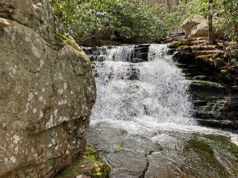
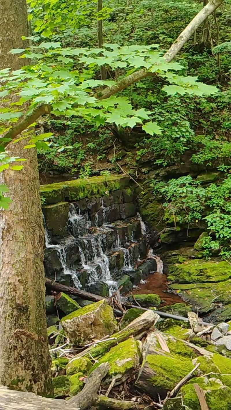
The Mill Creek trail system includes four waterfalls of varying sizes. They sit along the routes through Mill Creek Nature Park and give the climb several natural stopping points.
Waterfall flow changes with recent rain and seasonal conditions, so the same route can look different from one visit to the next. After wetter weather, the creeks may run fuller. During drier stretches, the cascades can be lighter.
That variability comes with hiking beside mountain streams. Take the conditions you get that day rather than building the outing around a particular water level.
Rock around moving water can be slippery, so keep to the established trail and avoid climbing onto wet ledges for photographs. A few extra feet of distance usually gives you a safer view anyway.
The waterfalls also make the loop easier to divide mentally. Instead of thinking about the entire hike at once, move from one section to the next and let each cascade mark progress.
Bring a snack, keep water handy, and save a little energy for the return. The uphill work does not disappear just because the creek is doing something interesting beside you.
Historic Stonework Adds Another Layer To The Park
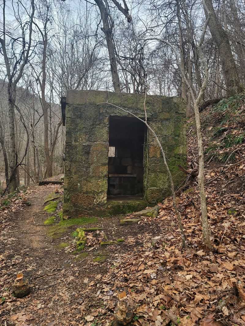
Mill Creek Nature Park is not only about water and forest. The route also passes historic stonework connected with an old mill and reservoir, adding an earlier chapter of local history to the trail system.
The surviving stonework traces back to a mill built in the late 1780s. The reservoir later served as a water source for Narrows until the 1970s.
You do not need to climb on the structure to appreciate it. Stay on the trail, look closely at the masonry, and let the contrast do the work. Old stone beside a wooded creek changes the rhythm of the hike without requiring a separate history stop.
That mix gives groups several things to notice along the same route. One person can focus on waterfalls, another on trail mileage, while someone interested in local history has the stonework to look for.
Pairing the dam area with the waterfall loop also keeps the scenery changing as you move through the park. The shift from creek crossings and cascades to old masonry gives the route a different feel without adding a separate drive.
Take your time around the older features. They have lasted a long time without help from hiking boots.
If you want a town stop before or after the hike, the Narrows Town Office and Visitors Center is at 210 Main Street, Narrows, VA 24124.
Rice Field Brings The Appalachian Trail Into The Day
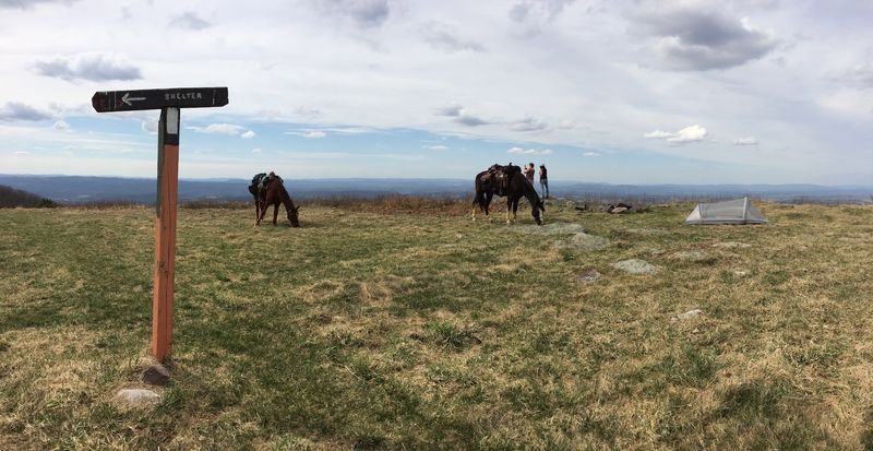
For a bigger climb, the Rice Field hike follows the Appalachian Trail toward the crest of Peters Mountain. The 5.2-mile out-and-back route is rated moderate to strenuous.
The hike gains just over 1,000 feet of elevation. The grade is generally steady, but the trail keeps climbing, which means the return trip can feel very different from the way up.
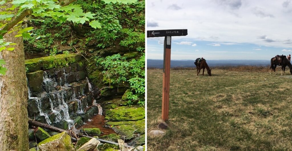
At the ridge, the trail reaches Rice Field, an open mountaintop meadow along the Virginia and West Virginia state line. Rock outcroppings provide broad views, and Rice Field Shelter sits near the wood line.
Narrows is one of Virginia’s officially recognized Appalachian Trail Communities, reflecting the town’s direct relationship with the trail and the hikers who travel through the region.
Bring enough water, carry a map, and do not count on reliable cell reception on mountain slopes. If you are considering sunset, add a headlamp before leaving the trailhead rather than trusting a phone flashlight.
This is the hike to choose when you want the day to feel substantial. Save the easier wandering for after you come back down.
Long-Distance Trails Keep Narrows Connected Beyond One Hike
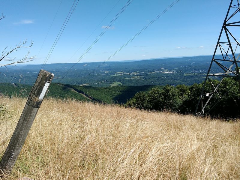
The Appalachian Trail is not the only long-distance route tied to Narrows. The Great Eastern Trail also passes through the community, giving the town another connection to a much larger hiking network.
The Great Eastern Trail stretches from Alabama toward New York through a developing system of established trails and connecting routes. In the Narrows area, the route passes through town before continuing toward Glen Lyn and West Virginia.
That places Narrows inside a broader trail corridor where local paths and long-distance routes overlap.
For most visitors, one day does not need to become an endurance project. Choose Mill Creek if waterfalls and woodland trails sound right, or pick Rice Field if you want the Appalachian Trail and an open ridge.
Check current trail updates before leaving, especially after storms or periods of heavy rain. Conditions on long-distance trails can change, and closures or reroutes occasionally affect access.
Then give yourself enough time to return without rushing the final miles.
Narrows may be small on the map, but the trail choices around it stretch far beyond town limits. That is useful when one hiking day quietly starts turning into plans for another.