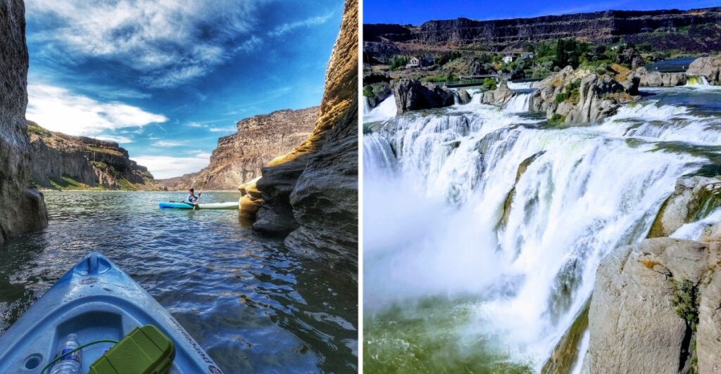
Niagara might want to look away for this part.
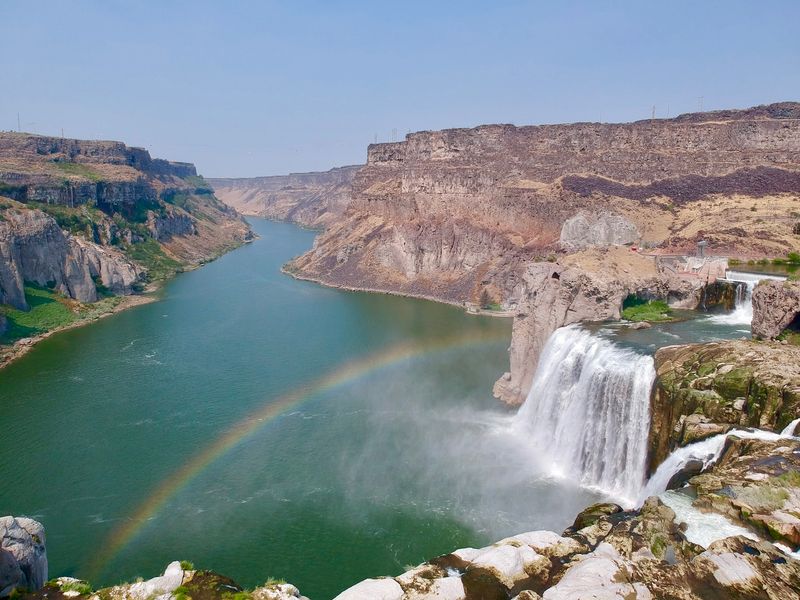
This Idaho waterfall drops 212 feet into the Snake River Canyon, making it 36 feet taller than its much more famous rival.
That gets your attention.
What keeps it is how much the view can change.
Snowmelt can send a broad wall of water over the basalt cliffs, while irrigation diversions later reveal more of the rock beneath. Visit at another point and the falls may look dramatically leaner.
So the numbers only tell half the story.
Overlooks give you the big view, while trails and nearby green space make it easy to hang around instead of treating this as a quick photo stop.
I would give the canyon a little time.
Two hundred twelve feet sounds impressive on paper.
It looks much better when you are standing there trying to fit the whole thing into one photo.
Shoshone Falls Drops 212 Feet Into The Snake River Canyon
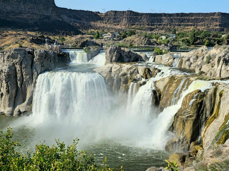
Two hundred and twelve feet of falling water gives Shoshone Falls a scale that is easy to understand once you reach the canyon rim.
The Snake River pours over a wide rock ledge and drops into a deep basalt canyon below. The falls stretch about 900 feet across, so strong flows can spread across a broad section of the rim rather than forming one narrow ribbon.
Dark volcanic rock frames the water and gives the canyon a sharp contrast against the river below.
The surrounding canyon matters almost as much as the height. Steep walls fall away from the rim while the Snake River continues through the gorge, giving the overlooks a much wider view than the waterfall alone.
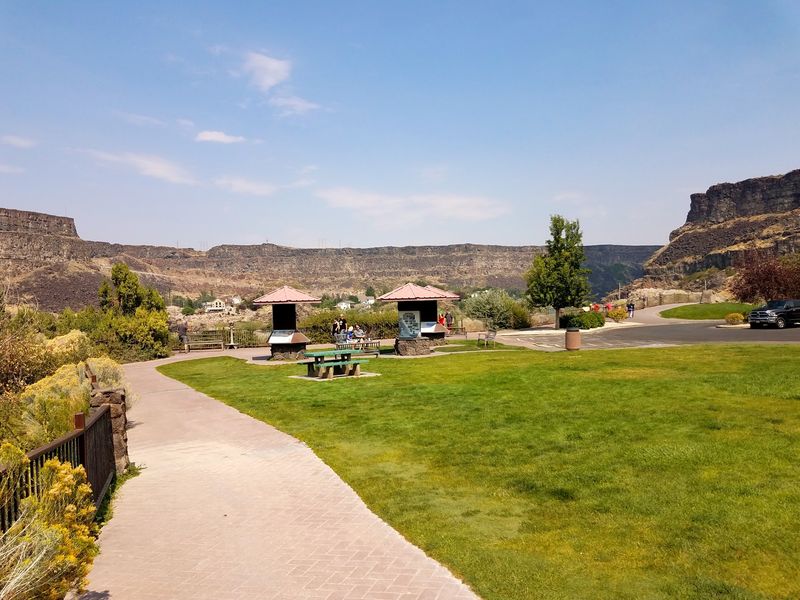
Several park facilities sit near the falls, including overlooks, picnic tables, open green space, restrooms, trails, and a concession stand.
That makes the visit easy to keep simple. Start at the overlook, take in the full width first, then decide whether you want to stay near the rim or add a walk and picnic to the stop.
Wind and spray can change with conditions, so a light extra layer is useful during cooler weather or stronger flow.
The Waterfall Stands Taller Than Niagara Falls
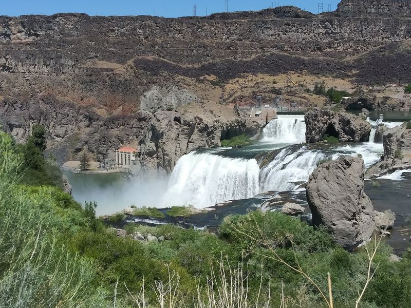
Shoshone Falls stands 36 feet taller than Niagara Falls.
The Idaho waterfall reaches 212 feet, while Niagara is lower in height but carries far more water overall.
That difference is important because the two falls behave very differently.
Niagara maintains enormous flow throughout the year. Shoshone Falls changes more dramatically with snowmelt, irrigation, and seasonal river conditions.
The “Niagara of the West” nickname points to the height and broad curtain of water, but the surrounding setting is distinctly southern Idaho. Basalt cliffs, open high-desert country, and the Snake River Canyon frame the falls instead of a heavily developed urban edge.
If you are comparing the two, height is only one part of the equation. Flow is the bigger variable here.
That is why checking current river conditions before a long drive makes sense. A spring visit may show water spread widely across the rim, while a later-season visit can reveal far more rock.
The waterfall stays in the same place. The amount of water over it does not.
Spring Runoff Brings The Most Dramatic Views
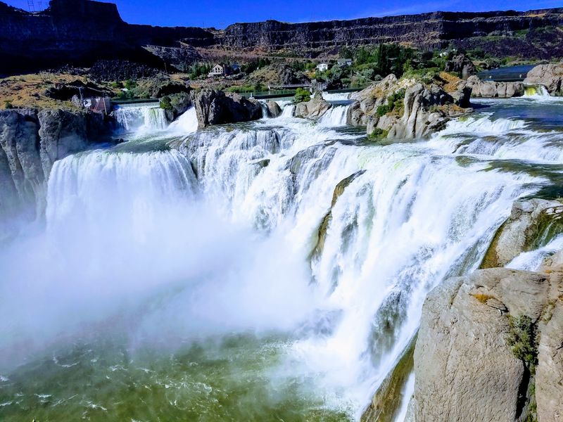
Mountain snow has a big job each spring. As temperatures rise, snowmelt feeds the Snake River and increases the amount of water reaching Shoshone Falls.
Spring is generally the strongest season for flow, with typical peak conditions reaching roughly 10,000 to 12,000 cubic feet per second.
At that level, water can spread across much more of the 900-foot rim and cover sections of basalt that become visible later in the year.
The exact timing and strength vary because snowpack changes from one winter to the next.
A heavier snow year can push more water downstream, while a drier winter may produce a shorter or less dramatic runoff period.
Spring weather in southern Idaho can also change quickly. Cool mornings, wind, sun, and mist can all show up in the same visit, so layers are a practical choice.
If strong flow is your main goal, spring is the season to watch.
The easiest plan is to check current conditions close to your visit rather than relying on a fixed calendar date. Snowmelt does not follow a tourism schedule.
When the runoff is strong, the falls show the widest version of themselves.
Summer Irrigation Can Change The Falls Completely
Farm fields across southern Idaho need water during the growing season, and that changes what you see at Shoshone Falls.
Part of the Snake River is diverted upstream for irrigation, reducing the amount of water that reaches the falls in summer.
Those diversions support more than 500,000 acres of farmland, making the river an important part of the region’s agricultural system as well as its scenery.
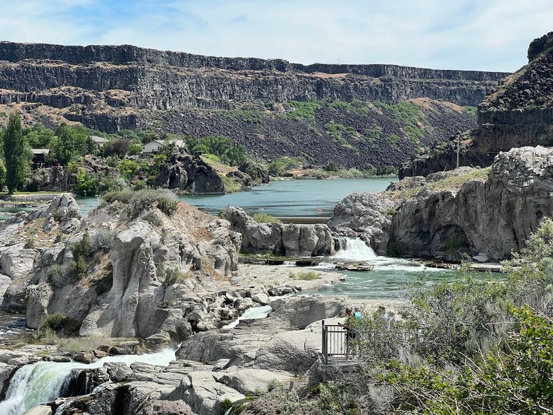
As flow drops, the broad spring curtain can break into narrower sections. More basalt ledges, cracks, and channels become visible beneath the remaining streams.
By fall, the change can be even more pronounced. The falls can shrink to minimal flow and may appear nearly dry during especially low-water periods.
That does not mean the canyon disappears from the experience. The rock walls, river, overlooks, and park remain, but the waterfall itself can look dramatically different from spring.
This is the section of the trip where expectations matter.
If you are visiting specifically for heavy water, check current flow conditions before driving out. If your timing is fixed, treat the season as part of what you are going to see rather than expecting the same waterfall every month.
Travelers Have Been Detouring Here Since The 1800s
Long before paved roads and modern parking areas, travelers were going out of their way to see Shoshone Falls.
By the mid-1800s, people traveling along the Oregon Trail were making side trips to the waterfall.
That meant leaving an already demanding route for additional miles across rough country, simply to reach the canyon and see the falls.
The waterfall became known well beyond southern Idaho, and by 1900 local advocates were already pushing for the area to become a national park.
Congress never approved that proposal, but the effort shows how early the falls had become part of the region’s travel identity.
Today, reaching the overlook is much easier, but the basic geography is unchanged.
The approach moves from open agricultural land and high-desert scenery to a steep canyon above the Snake River.
You can arrive by paved road, park near the developed area, and reach established overlooks without anything resembling an Oregon Trail detour.
People were making extra miles for this view long before paved roads reached the canyon.
The Surrounding Land Became A Public Park In The 1930s
The public park around Shoshone Falls took shape in the early 1930s.
In 1932, Frederick and Martha Adams donated 68 acres to the City of Twin Falls. Idaho added another 150 acres in 1933, bringing the property to 218 acres.
Those additions helped secure public access to the waterfall and surrounding canyon rim.
Today, the park includes overlooks, picnic tables, grills, restrooms, drinking fountains, trails, open green space, biking access, and a concession stand. A Snake River boat launch is also part of the facility.
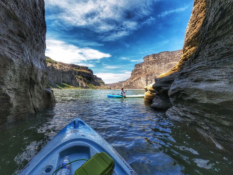
Nearby Dierkes Lake adds swimming, fishing, nonmotorized boating, picnic areas, and a 1.7-mile unpaved loop trail.
Shoshone Falls Park is at 4155 Shoshone Falls Grade Road, Twin Falls, ID 83301.
A seasonal vehicle-entry fee applies during part of the year.
For 2026, the entrance gate is currently operating from 7 a.m. to 9 p.m. under a temporary schedule, with weather or road conditions still able to affect access.
That makes checking current park notices useful before a winter visit or a late-evening stop. The developed park keeps the main overlook easy to combine with a picnic or a short walk, while Dierkes Lake gives you a separate option if you want to stay in the area longer.
The Falls Change With The Season But The Canyon Stays Constant
Shoshone Falls and nearby Dierkes Lake together receive more than 300,000 visitors in a typical year, so this is not an unknown corner of Idaho.
What changes most dramatically is the amount of water crossing the rim.
The waterfall can look completely different from one season to another. Spring may bring a broad wall of water. Summer irrigation can thin the flow.
Fall may expose much more of the basalt rim.
The canyon stays as the constant backdrop.
That gives you several ways to build the stop depending on timing. A strong-flow visit can stay focused on the overlooks. A warmer, lower-flow day may leave more room for a picnic, a walk, or time at nearby Dierkes Lake.
You do not need a full day unless you want one.
For a road trip, the falls can work as a focused stop. For a slower afternoon, the park facilities and nearby lake give you more room to stretch the visit.
Shoshone Falls may look very different from photos taken during another season.
It is which version of the Snake River is waiting when you get there. That uncertainty is part of planning this stop well: check the flow, check the gate schedule, and then let the season set the pace once you reach the canyon rim.